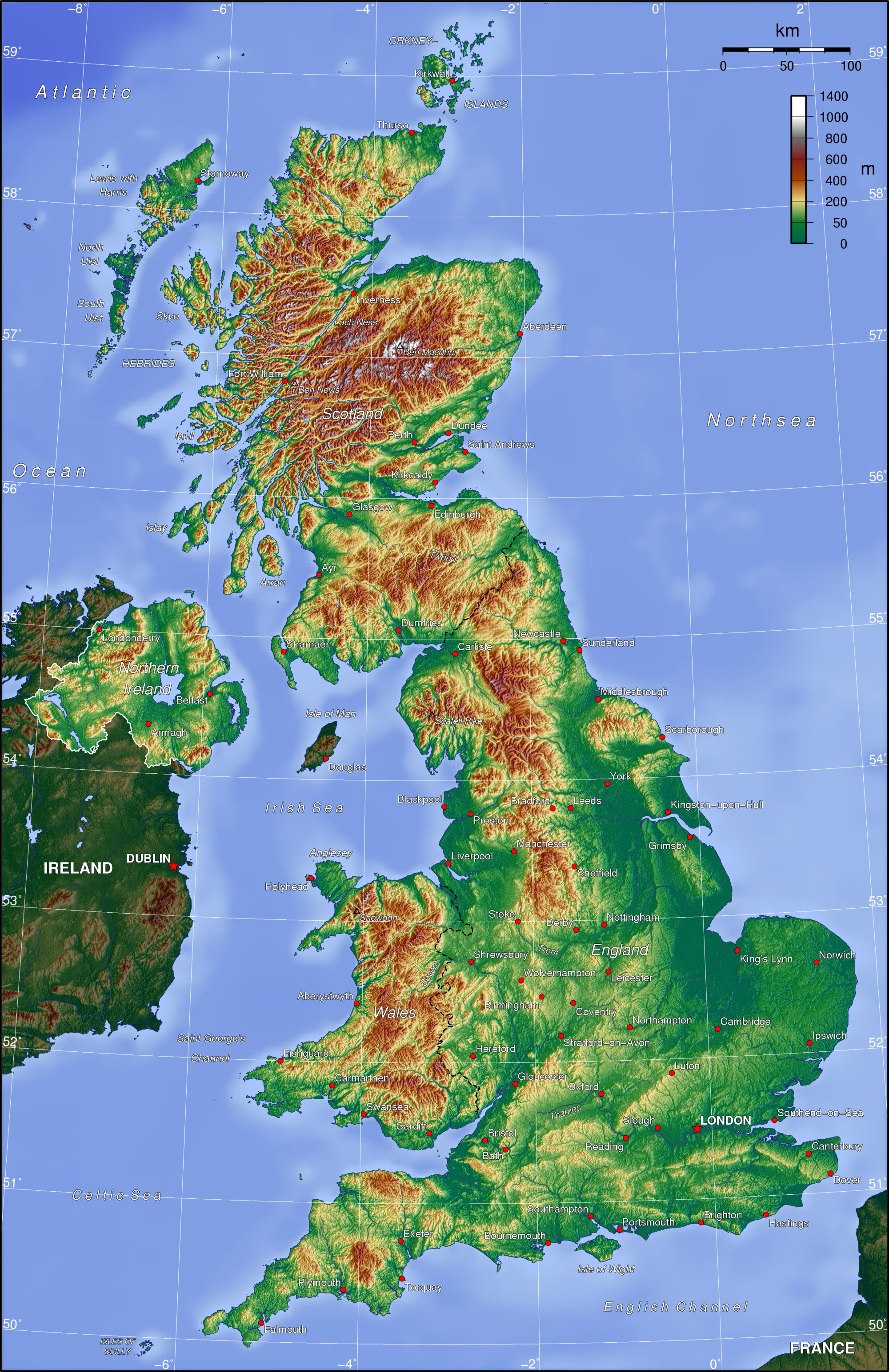
The above map is an example of a Hypsometric map. As defined
in the Mcgraw-Hill Science and Technology Dictionary a hypsometric map is, “in
topographic surveying, a map giving elevations by contours, or sometimes by
means of shading, tinting, or batching.”
That being said, a Hypsometric map is also as topographic map as
hypsometric is often a word used for elevation tinting of a map. They above map is a hypsometric map of
the United Kingdom, the country where my other roommate is for the summer, as
well as where the Summer Olympics are being held. In this Hypsometric map of the UK shows the country’s
different extremes of elevation.
The map URL is: http://en.wikipedia.org/wiki/File:Uk_topo_en.jpg
No comments:
Post a Comment
Note: Only a member of this blog may post a comment.