Keeping with the meteorology theme of the last few posts,
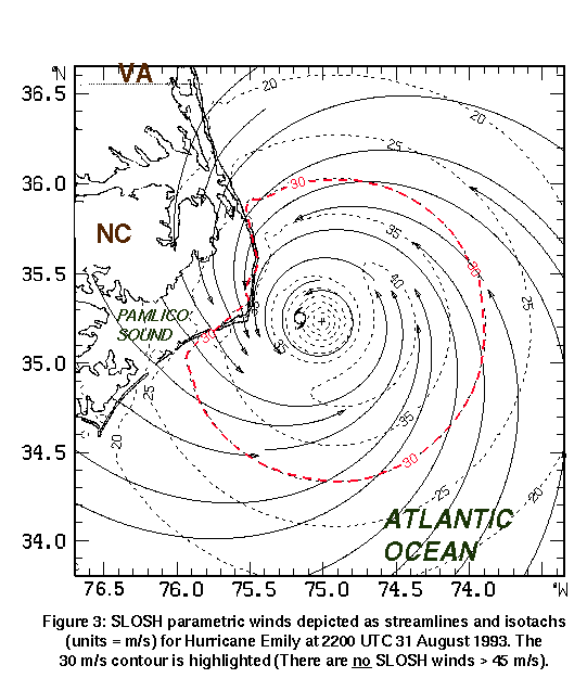
the above map is what is known as an isotachs. An isotachs is line in a given surface connecting points
with equal wind speed. This is
similar to the below map of an isobar.
The above map is showing the wind speeds of hurricane Emily that hit
North Carolina and Virginia in 1993.
As you can see from the map the highest wind speed sustained in this hurricane
was 40 mph.
The map URL is: http://www.aoml.noaa.gov/hrd/project97/sh_proj3.html

No comments:
Post a Comment
Note: Only a member of this blog may post a comment.